


Google Earth finally updates its imagery for Afrin city (p.1)
Extensive excavations of archaeological sites and deforestation
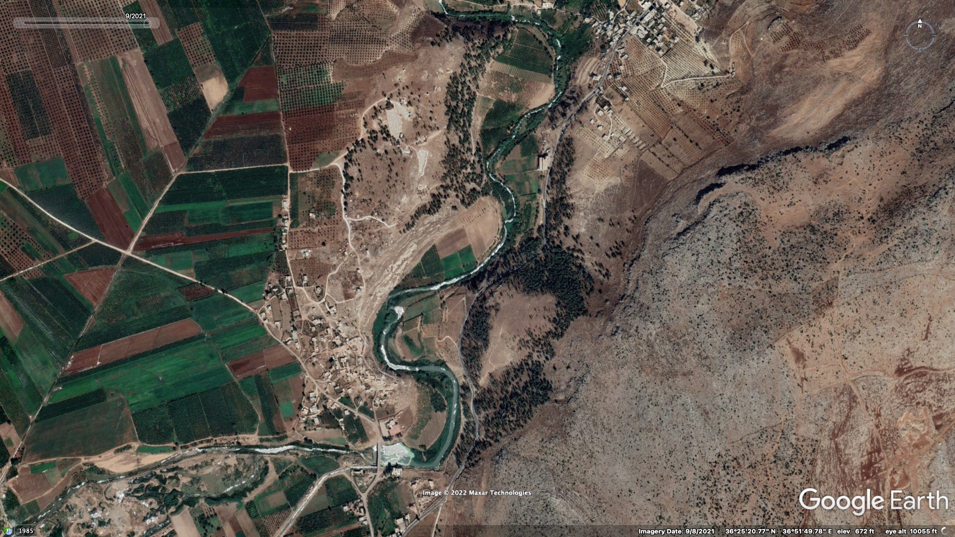
For years the most recent imagery available on Google Earth for Afrin city and the surrounding region dated back to September 2019. At some point this past month this was finally (rectified) updated with the publication of imagery captured on September 8th, 2021. Within this two year window significant changes have occurred to the physical and urban environments. Part one of this post highlights visible excavation activity of archaeological sites as well as areas affected by deforestation.

Archaeological sites
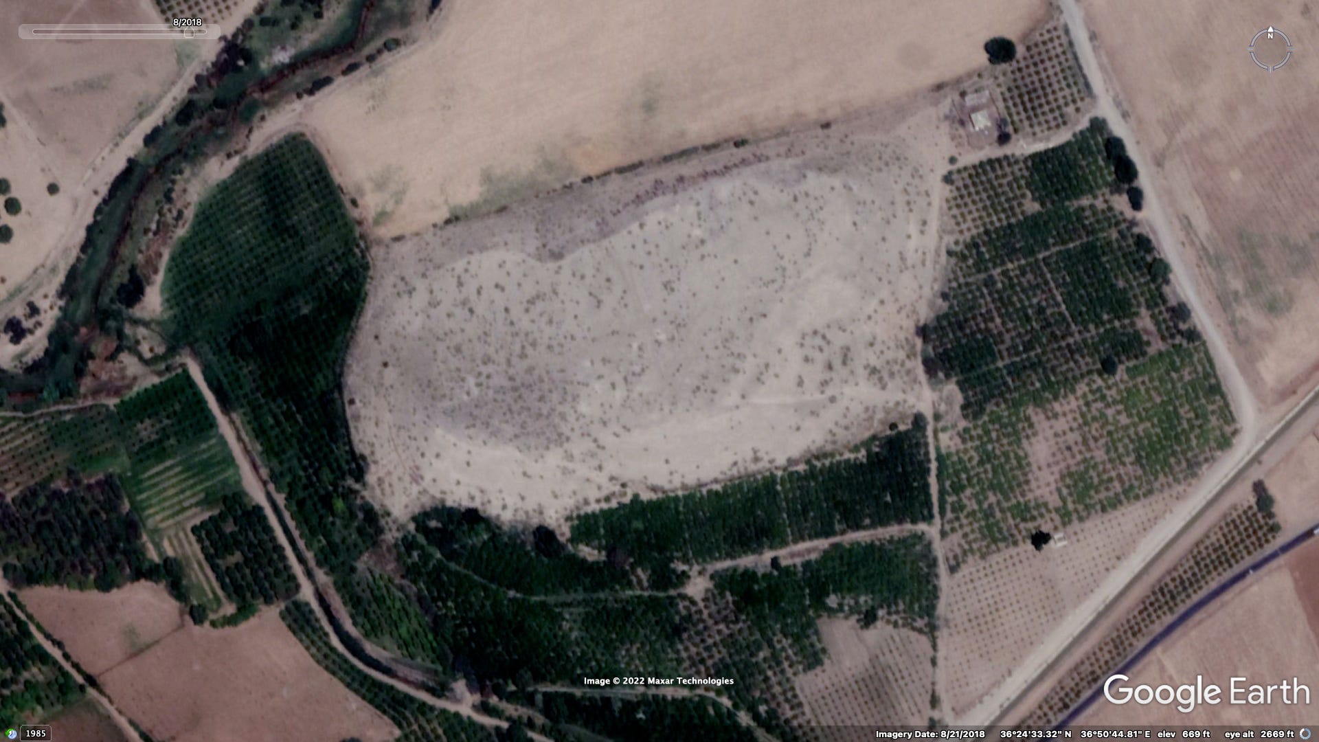
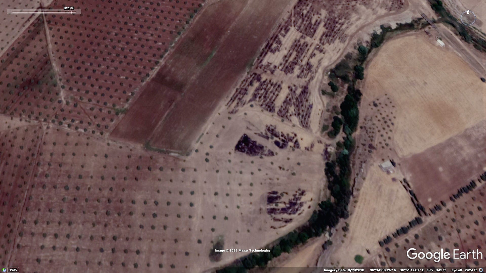
Since the 2018 invasion of the region many of Afrin’s archaeological sites have been crudely excavated by individuals (commonly believed to be affiliated with the SNA) in search for artifacts to sell on the international black market. The systematic nature of these efforts are quite visible within the Afrin river valley (also known as the Cuma plain). Numerous ‘tells’ are situated in the vicinity of Afrin city. These are small artificial hills made over centuries of early human settlement through the gradual build up of debris and natural sediment.
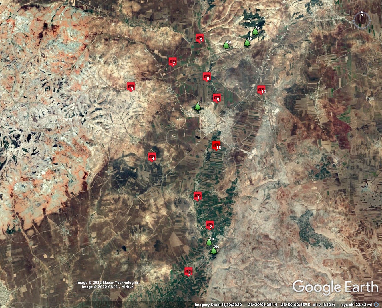
While one such site, ‘Ain Dara, is internationally famous due to a well-preserved neolithic temple situation at its summit, most of these sites have not been excavated professionally meaning there is no knowledge regarding what artifacts might be present. Some of these tells were registered by the Syrian Ministry of Culture in 1981 under a Resolution 244 (which I have yet to find the text of). Within the area covered by this new satellite imagery update eleven such sites are visible, each showing clear signs of excavation via bulldozer. Worth noting that most of this activity took place in 2019 and 2020 so some imagery detailed below shows sites months or even a year after the excavations took place.
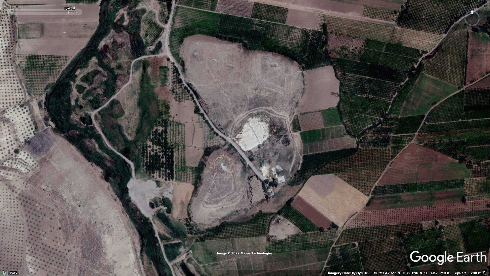
1. ‘Ain Dara
Location: 36.458968, 36.852563
More in this 2019 investigation by Syrians for Truth & Justice

2. Tell Basoutah
Location: 36.440357, 36.863150


3. Tell Burj Abdallo
Location: 36.408968, 36.844772

4. Tell Maratah
Location: 36.486765, 36.814034


5. Tell Juwayq


6. Tell Zountri
Location: 36.568136, 36.854630

7. Tell ‘Ain Dibah
Pre-2018 imagery shows what appears to be a YPG defensive trench dug along the edge


8. Tell Khalah
Location: 36.541661, 36.860559


9. Tell Joumkah


10. Tell Turandah
Pre-2018 imagery shows what appears to be a YPG defensive trench dug along the edge


11. Hisn Qibar
Location: 36.531946, 36.906774
This site isn’t actually another tell but rather believed to be the remains of an 11th century castle built within the context of the Crusades (perhaps affiliated with the Mirdasid emirate?)


Deforestation
Except from a newsletter of mine published at the beginning of September highlighting this topic:
Prior to the war, Afrin was one of the most forested parts of (non-coastal) northern Syria, due in part to extensive reforestation efforts over the twentieth century. Since the Turkish invasion of 2018, much of these forests have disappeared. This logging is primarily carried out to in order to procure firewood in the face of fuel shortages and as well as to produce charcoal. While this is partially conducted by local civilians (particularly recently arrived IDPs often residing in tents), there have been numerous reports of SNA factions engaging in such activities as profit seeking ventures. Documentation of this behavior and the effects of such is somewhat scarce compared to what is visible via satellite, and often times videos of deforested areas are of low quality and filmed at a distance due to fear of persecution by the perpetrators.
1. al-Mahmoudiyah/Afrin city forest
Since the regime’s 2020 offensive in Idlib, this once forested hilltop has become an informal IDP camp, the inhabitants of which have turned to logging as a heat source due to fuel shortages.


2. Forested hills south of the town of Basoutah
Location: 36.427479, 36.863072
As will be detailed in part two, Furqat al-Hamza has constructed a training camp on deforested northwestern hilltop.

3. Forests in the vicinity of Qurt Qulaq village


More in-depth investigations on these two topics are forthcoming…
The loss of both 'assets' is tragic. Thanks for reporting on this Alexander.