Afrin 360: Street View user uploads to Google Maps
While Google Maps’ stitched-image street view coverage does not include Syria, users have been able to upload geotagged 360-degree panoramas using supported devices since 2012. Most of these images have been uploaded from locations in the country’s major cities, particularly along the coast. In Afrin, several dozen such panoramas exist on Google Maps, shared by individuals both prior to and after the 2018 invasion of Turkey and its proxy militias. Aside from its usefulness in open-sourced investigative work, such 360° imagery provides unique documentation of the region’s beautiful landscape of rolling hills and olive tree groves while offering small glimpses into daily life both pre- and post-2018. Furthermore, the glitchy-ness of the technology and its use in human hands creates bizarre and visually compelling collages. Below are some (most) examples….
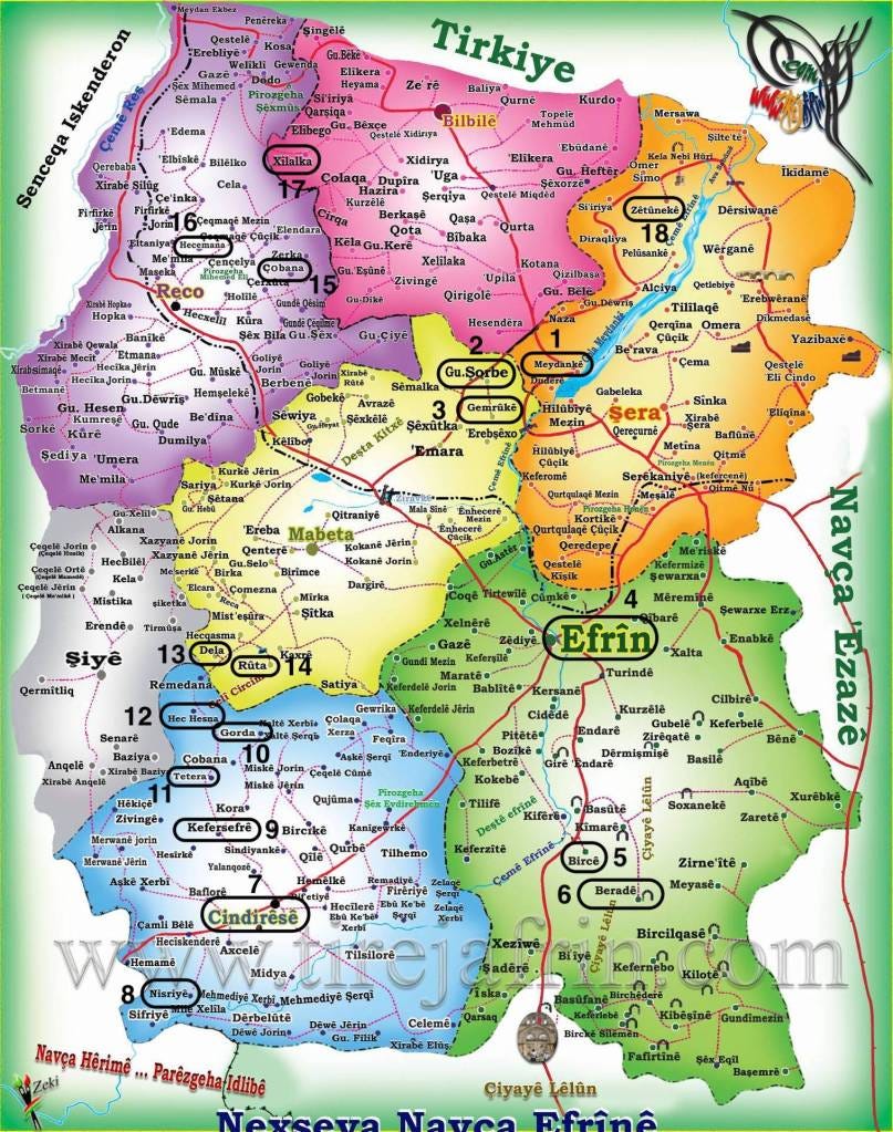
Lake Meydankê (بحيرة ميدانكي)
This artificial lake was formed by the Meydankê or 17 Nissan Dam built on the Afrin river in the subdistrict of Şera/Sharran, north of Afrin city. The dam's construction finished in 2004, permanently changing the landscape as well as submerging several local landmarks including waterfalls, an ancient bridge and a watermill. Since then, the lake has been a tourist attraction, drawing locals and travelers from elsewhere in Aleppo. Prior to the Turkish invasion in 2018 the western banks of the lake were frequently the site of large Newroz celebrations. Since the invasion and the large influx of displaced populations arriving afterwards, multiple swimmers have drowned in the lake likely due to ignorance of the underwater currents created by the dam.
Şorbe (شوربه)
This hilltop village in the Mabeta/Ma'batli subdistrict was reportedly named after soup cooked by the local aghas for its inhabitants during a famine two centuries ago. Prominent historical figures from Şorbe include Aslan Agha, a leader in the local anti-French resistance occurring in the early years of the Mandate, and Esmet Omer, a communist lawyer elected to the Syrian People's Assembly in 1986.
Gemrûkê Falls (شلالات كمروك)
A local tourist site in the Mabeta/Ma'batli subdistrict comprising of a waterfall and park, located on the Afrin river between the Meydankê dam and Afrin city. The image was taken after the Turkish invasion, likely by and of non-locals.
Efrîn/Afrin City
A view of the city from the southwest, showing Tell Mahmudiyyah and the Mahmudiyyah neighborhood rising to the left.
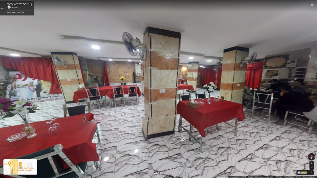
The interior of a restaurant off al-Villas street, on the western edge of the city. While the image was taken in December 2018 it's unclear whether the restaurant was opened before or after the Turkish invasion.
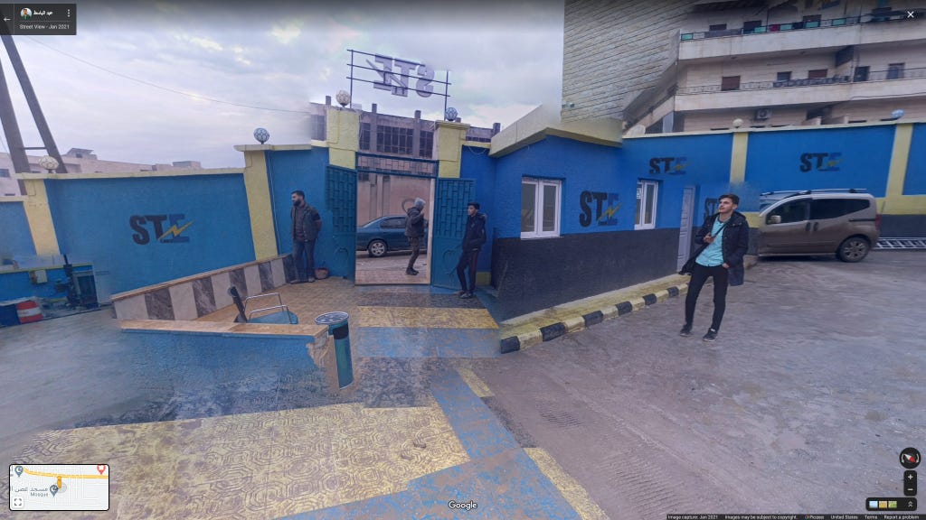
The inside of the Mahmudiyyah neighborhood headquarters of STE (Syrian Turkish Enerji), an energy company formed after the 2018 invasion active in Afrin and Euphrates Shield areas.
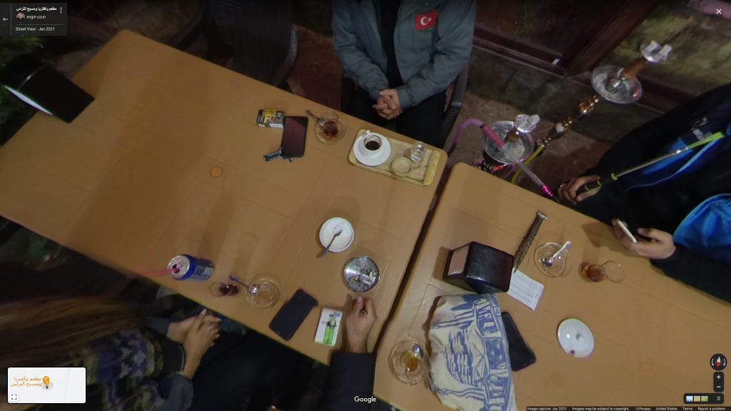
An image from the interior of a restaurant in between Afrin city and the hilltop village of Kafr Shil. The uploader is a Turkish photographer who has frequently worked with the Turkish government. His presence in Afrin is part of the larger influx of Turkish NGOs and state entities to the region following the 2018 invasion.
EDIT: This establishment was known as 'Hawar Restaurant' prior to the invasion and was owned by Dr. Riyadh Manla Muhammed from nearby Juwayq village. Dr. Riyadh Manla was kidnapped by Turkish-backed forces and held for two and a half years, only released in March 2021. Several of his properties in Afrin were seized by Turkish-backed militant factions, including his restaurant - reportedly owned in 2019 by a man from Douma, Damascus.
Bircê Abd-Allo (برج عبد الله)
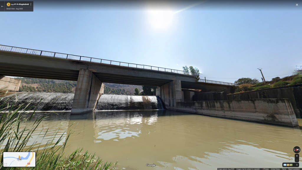
A picture of the Bircê Abd-Allo/Burj 'Abdullah dam and bridge on the Afrin river. This scenic southeastern village in the Afrin/Markaz subdistrict sits at the foot of Jebel Laylun, the rocky stretch of hills that form Afrin's eastern border. The remains of two Neanderthal children were found at the Duderiyeh Cave, located in wadi just east of the village, site during several excavations occurring since 1993.
Beradê (براد)
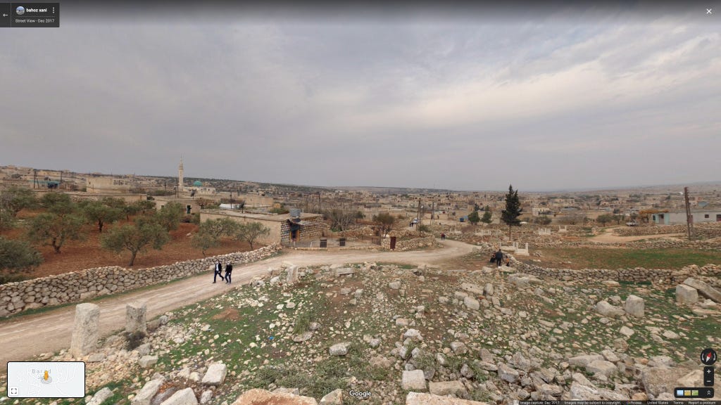
The village of Beradê/Barad is located in the middle of Jebel Laylun and is home of several sites belonging to Syria's Dead Cities, abandoned settlements from Late Antiquity and the Byzantine era. Lying adjacent to Beradê's Julianos Basilica is the what is believed by some to be the tomb of St. Maron, spiritual father of the Syriac Maronite Church, drawing thousands of pilgrims including Michel Aoun in the decade prior to the war. These images were taken at the 'Northern Church,' built in 561 A.D. and located just northwest of this site.
Cindirês (جنديرس)
Cindirês is the second largest city in the Afrin region, located in the southwest just 8km from the Turkish border. It's been the site of human settlement for millennia, lying on the road between the ancient cities of Cyrrhus and Antioch.
Nisriyê (نسرية)
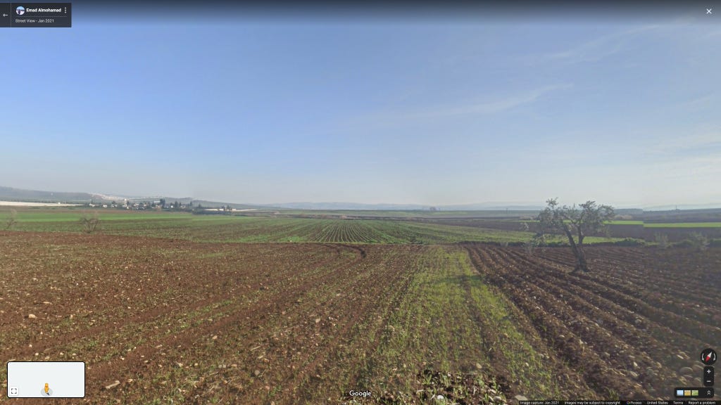
These images were taken in fields located in the southwestern most corner of Afrin, surrounded on three sides by Turkey, near the village of Nisriyê. In the third picture one can make out the recently constructed Turkish border wall, a project which began in 2015. Measuring at 911km it is the ninth longest border barrier in the world. The militarized nature of the wall is evident in the frequent killings of refugees attempting to cross, at the hands of the Turkish Jandarma.
Kefersefrê (كفر صفرة)
Kefersefrê/Kafr Safrah is a historic town located on the northern hills overlooking Cindirês. Just north of it lies the 'Martyr Seydo' YPG cemetery, on Jebel Qazqali, destroyed during and after the Turkish invasion in early 2018.
Gorda (كوردان)
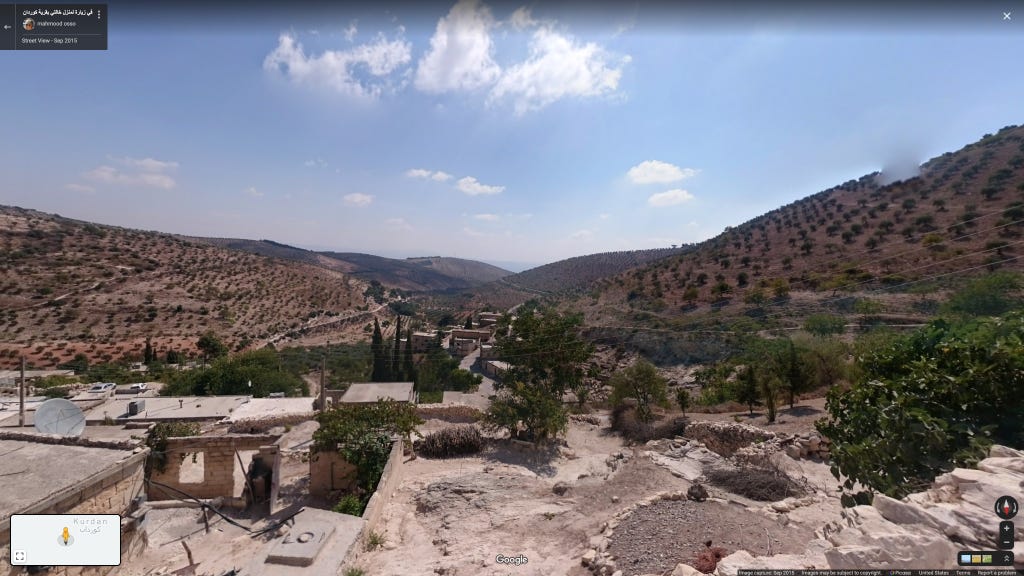
This image was taken in Gorda, a hillside village in northern Cindirês. To the east of the village lies a forested valley known as "the hell of death" (Ole Ce'nim/جهنم الموت), apparently at some point a refuge for wanted persons.
Tetera (تاتارانلي)
Tetera is a small village located on the peak of Jebel Qazqali, in northern Cindirês. The headquarters of anti-French resistance figure Miĥo Îbo Şaşo, who reportedly fired the first shot against French troops in the area, was located in a cave near the village. This was also the site of his death in 1939, reportedly at the hands of relatives collaborating with the French.
Ĥec Ĥesena (حاج حسنلي)
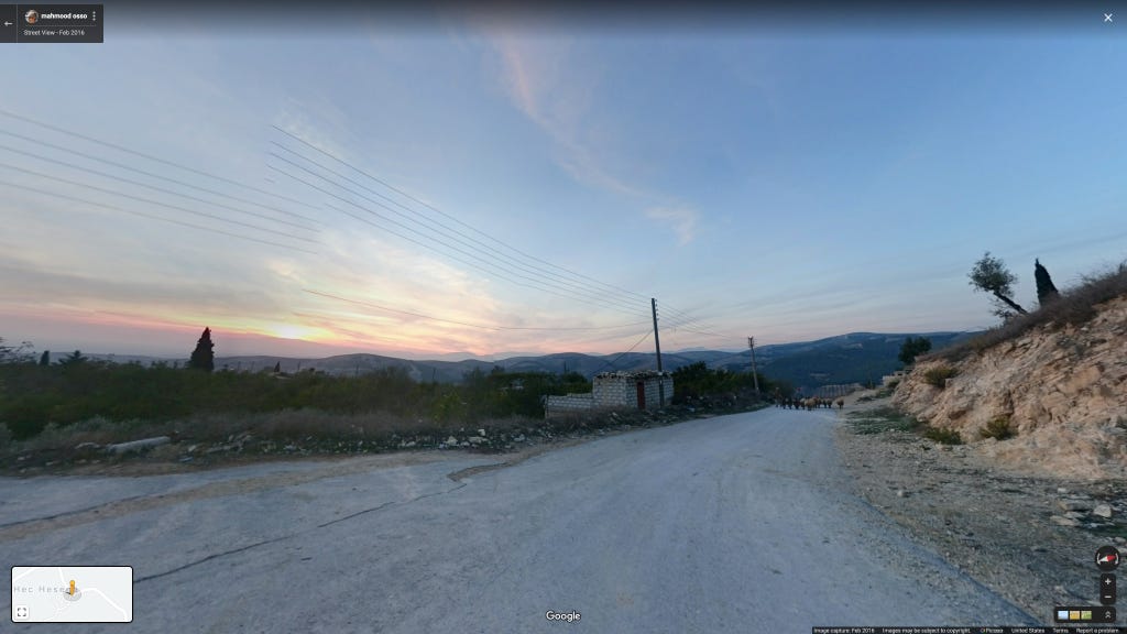
Ĥec Ĥesena is located in northern Cindirês, in the northern hilly region where the subdistrict meets the borders of Şiyê/Sheikh al-Hadid and Mabeta/Ma'batli. The area is reportedly rich in archaeological remains, particularly pottery fragments and carvings on the walls of limestone caves.
Dela (داليانلي)
The village of Dela lies in the hilly southwestern corner of Afrin's central Mabeta/Ma'batli subdistrict.
Rûta (روطانلي)
The village of Rûta lies in the hilly southwestern corner of Afrin's central Mabeta/Ma'batli subdistrict.
Çobana (جوبانلي)
This iamge were taken in the village of Çobana, on the eastern edge of the Reco/Rajo subdistrict, looking in the direction of Afrin's central Hawar mountain.
Ĥucemala (حجمانلي)
This image was taken southwest of Ĥucemala village in the Reco/Rajo subdistrict, following the road down to the town of Rajo.
Xilalka (صولاقلي)
This image was taken on the road traveling west from Xilalka, a village in the Bilbilê/Bulbul subdistrict. Xilalka is apparently home to a number of university graduates holding degrees from former socialist countries, a testament to Syria's Cold War relations with both the Soviet bloc and Non-Aligned Movement.
Zêtûnekê (زيتوناك)
The village of Zêtûnekê belongs to the Şera/Sharran subdistrict and lies between Lake Meydankê and the remains of the ancient city of Cyrrhus, founded in 300 B.C. by Seleucus I Nicator.
Map of all locations detailed:


